Attock Field Visit - Geology
Attock Field Visit - Geology
University of Peshawar

Attock Field Visit -The Story
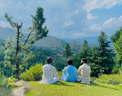
Our Geology field trip to Attock Cherat range was held on 4, March, 2021, by Geology Department, University of Peshawar. University of Peshawar arranged these geological trips to different areas of geological importance for the students of Geology Department to discover and examine the various techniques used in the extraction and identification of various rocks and minerals in their native rich habitate.
The main purpose of this field was to make students learn different geological features and structure of Attock and Cherat Area. On this field trip, we learned to identify different kinds of rocks, and observed numerous fluvial features at Kabul River and Indus River.

Attock geography
The Attock Cherat Ranges surround Peshawar Basin from South while the Northern side is bounded by Malakand Range and on the east and west by the Gandghaar and Khyber Ranges respectively. The Attock Cherat range borders Peshawar intermontane Basin from south-east. Due to its central location, it holds a pivotal position in the regional geological setup of south- east Pakistan. Tectonically, it belongs to Hazara, Khyber and Kara Chitta mountain system which are closely located. This range consist of various rocks types and geological features which belongs to Precambrian to Paleozoic era.

Attock Geology
The most abundant rocks of
these ranges are less metamorphosed and argillaceous Slate and Limestone of Precambrian age
intruded by dolerite sills and dykes, whereas Quartzite, Dolostone, Siltstone, Argillite and low grade metamorphosed Phyllite were also found.
Two major thrust faults, running along the southern and northern fronts of range divide the area into three blocks which further consist of different formations. These formations contain many important rocks such as Slate, Phyllite, Limestone and quartzite.
Also Read: Khewra Geology Field Trip

In Attock - Cherat Geology field trip, we gained a lot of knowledge about the Attock Cherat Range. Attock Cherate Rnge is furthur divided into three main blocks:
- Northern block
- Central block
- Southern block
These Blocks are further divided into formations.(FORMATION: A body of considerable thickness, large enough to be mappable and helps in differentiating adjacent rock’s units.)
The Northern Block has four formations,
- Manki
- Shekhai
- Shahkot
- Utch Khattak Formations
While Central Block has only one formation;
- Dakhner Formation.
The Southern Block has
- Darwaza
- Hisartang
- Inzari Formations
Stations:
- River Kabul
- Manki Formation
- Utch Khattak Formation
- Dakhner Formation
- Darwaza Formation
- River Indus
 First of all, we stationed at River Kabul, there we studied various riverine features such as meanders, flow of river, ripple marks, point bars, natural levees and flood plains. Moreover, the flow was laminar due to the heavy suspended load.
Manki Formation is dominated by Slates known as” Manki Slates”. Shahkot and Shekhai Formation consist of grey Limestone and phyllite. Utch Khattak Formation consist of Limestone of heterogenous colors and rubbly apperearance.
In Central Block, the Dakhner Formation contains mainly siltstone and quartzite while here Limestone is constituting the Hangwall Portion.
Darwaza Formation consist of green and maroon Slates, Shales, along with Limestone, Dolomite and Quartzite.
We also studied different riverine processes and sedimentary structures of River Kabul and River Indus there, which includes flow, load carried by the river, meanders point bar, flood plains, natural levees deposits, pot holes, ripple marks alluvial fan.
Attock Field Objective
With the theory we study, it’s essential to develop the application of practical skills and to understand the complexity of the real geology. Geological field work is actually practice by direct observation of outcrops, exposures and landscapes etc. and is important to recognize various geological structures and features. It seeks to describe and explain the surface features as well as the underground structures of earth based upon observations and inferences.

Students learn to identify
different rocks types and geological features through these field trips. The main field objectives are:
- To observe different riverine features
- To learn identification of different rocks types
- To study various geological structures
Also Read: Nizampur Geology Field Trip


very impressive!
ReplyDelete